
What Does Professional Aerial Photography Involve for Corporate and Property Projects in Singapore?

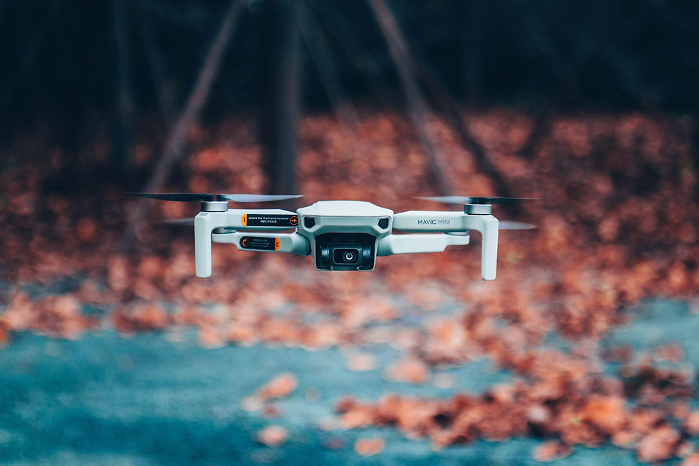
A marketing manager has a launch date, a brochure still missing its hero image, and a folder of drone images that look fine on a phone but are not sharp enough for print. A property developer has a finished project that no ground-level photograph can show properly. In both cases, the useful question is what a professional aerial photography commission actually involves, and what needs to be agreed before anyone flies. In short, it is a planned piece of work rather than a single flight, covering the brief, the site, the capture and the finished files. This article walks through what that looks like for corporate and property projects in Singapore, so that teams can prepare a clear brief before requesting a quote.
What Defines Professional Aerial Photography?
Professional aerial photography is planned around a specific purpose, captured with suitable equipment by a licensed operator working within CAAS requirements, and delivered as edited files ready for the intended use, whether that is a website, a brochure or a large-format print.
A general aerial view shows what a place looks like from above. A commissioned image answers a narrower question: what does this image need to do? That shapes everything that follows, from the time of day chosen for the shoot to the flight height and the way the files are finished. Equipment is part of the picture too. For its aerial photography and videography work, the list includes DJI Inspire 3 series, as well as heavy-lift drones that carry Red, Sony and Arri camera systems, on the frequently asked questions page. Operator credentials are the other half. Commercial drone operations in Singapore are regulated by the Civil Aviation Authority of Singapore (CAAS) and require CAAS permits. We the Flyers’ pilots are CAAS-certified, and the team handles the required permits as part of each project.
What Happens in a Professional Aerial Photography Commission?
A professional commission generally moves through five stages: a briefing, a site and airspace review, the capture itself, selection and editing, and delivery of the final files.
Each stage exists to prevent a familiar problem: a shoot that succeeds technically but misses what the project needed. The briefing fixes the purpose and the finished format before anyone flies, the airspace review confirms the permits and clearances that the location, date and flight height require, and editing turns raw captures into a consistent set rather than a pile of near-duplicates.
# | Stage | What It Involves |
1 | Briefing | The purpose of the images, where they will appear, and the viewpoints or features that must be shown. |
2 | Site and airspace review | A check of the location, date and intended flight height, and of the permits and clearances required before the shoot. |
3 | Capture | Flights carried out to the agreed shot list, timed around light and weather conditions. |
4 | Selection and editing | Images are chosen, colour-matched and finished for their intended use. |
5 | Delivery | Final files supplied in the formats agreed in the brief. |
We manage these stages, from permit handling and flight planning through to editing and delivery. Published examples of the company’s work are on its productions page.
Which Corporate and Property Projects Benefit from Professional Aerial Photography?
Projects where scale, location or context cannot be shown from the ground benefit most, including property developments, corporate sites and facilities, and large events. The common thread is context: aerial images show how something sits within its surroundings.
How Does Aerial Photography Support Property and Development Projects?
For developers, aerial images can show a development’s relationship to nearby roads, parks and transport links, as well as the overall layout of the site. Images taken at different stages can also document how a site has progressed. Because these images are often used in brochures, sales materials and websites, image format and resolution are best agreed before the shoot rather than after it.
What About Corporate Campaigns and Events?
Corporate teams tend to need aerial images for annual reports, brand campaigns and site overviews. Event organisers use them differently: an aerial view of a venue or route often becomes a key image for post-event reporting and sponsor material. Event coverage has its own planning considerations, which are covered in our article on how drone video and photography can enhance corporate events.
What Should You Prepare Before Requesting a Quote?
Preparing the purpose of the images, the location, the preferred dates and the file formats needed lets a provider assess the work properly and respond with an accurate quote.
For drone photography in Singapore, a clear brief covers four points, whether the project involves one site or several:
• Purpose and audience: where the images will be used, such as a website, a printed brochure or a large-format display.
• Location and access: the address, a site contact, and any known access arrangements, such as building security or rooftop access. Sites near airports or in restricted areas may require additional approvals, so share the location as early as possible.
• Timing: preferred dates, and whether a particular time of day matters for the look of the images.
• Deliverables: the number of images, the file format and the resolution required.
We the Flyers encourages to request a quote for aerial photography and videography projects as each project may involve different locations, equipment, deliverables and scheduling requirements. Sharing a clear brief helps the team assess the scope and provide a suitable quotation.
Frequently Asked Questions
How far in advance should an aerial photography shoot be booked?
As early as possible, ideally as soon as the dates and location are known. Commercial drone flights in Singapore require CAAS permits, and the lead time depends on the location, the scope of the flights and the approvals involved, so confirm the timeline with the team when requesting a quote.
Does the time of day affect aerial photographs?
Yes. Light changes how a site looks from above, and weather can affect whether a flight goes ahead, so the best timing depends on the site and on what the images need to show.
How are file formats and resolution decided?
They are agreed in the brief, based on where the images will be used. Stating whether the images are for web, print or large-format display allows the delivery format to be confirmed before the shoot.
Can one project cover both photographs and video?
Yes. Aerial photography and videography using drones can be planned together within one project, but each has its own shot list and editing, so it helps to state which are needed in the brief.
Ready to Plan an Aerial Photography Project?
Professional aerial photography depends as much on the planning around the flight as on the drone itself. A clear brief, a properly reviewed site and agreed deliverables are what turn a flight into images a project can actually use. We the Flyers provides aerial photography and videography services in Singapore, and teams ready to discuss a project are welcome to request a quote.


Comments